 |
| Southwater Country Park |
After my trip out on the High Weald Landscape Trail my feet hurt and rather than sit around and waste the good weather that the South East was uniquely enjoying this week, I decided on a change of tack for my next trip out. I have been meaning to take a look at some of the cycle tracks that have made use of disused railway corridors in the area around where I live. I’m not much of a cyclist these days, but having walked disused railways in the past, I think that a bike is probably a much better way of exploring these routes.
A regular trip for our family is the southern section of the Downs Link, which once formed the Adur Valley line between Horsham and Shoreham-by-Sea and once stopping at the villages of Southwater, West Grinstead, Partridge Green, Henfield, Steyning and Bramber en route. We have regularly walked and cycled bits of this route for some years, but I have never once ventured north of Southwater. Although the line only ran as far as Christ’s Hospital about a mile and a half north of Southwater, the Downs Link bridleway actually continues north along the old Horsham – Guildford line and passing through the villages of Slinfold, Rudgwick, Baynards, Cranleigh and Bramley. Since the route to Guildford was a bit ambitious for me I decided to go only as far as Cranleigh, making for a 25 mile round trip. One day I think I shall give the whole route a try, by taking the train to Guildford then cycle to Shoreham before returning to Worthing along the coast. For now though my ambitions need to be a little lower as I no longer have a cyclists posterior if you know what I mean!
For a complete route guide take a look at the excellent leflet produced by West Sussex County Council, which can be purchased as a hard copy for £2 or downloaded for free at http://www.westsussex.gov.uk/leisureandtourism/prow/pdfs/DownsLinkRouteGuide.pdf . If you don’t have your own bike or don’t want to be bothered transporting it, you can also rent bikes in Southwater at http://www.southwatercycles.com/
Southwater Country Park has a great car park and refreshment stop, which is very useful if you are planning a trip on the Downs Link. Today, although a mid week day the car park was virtually full with families taking advantage of the good weather during the Easter school holidays. I headed north to the site of the old Southwater station, which as far as I have previously gone. The station site is almost completely changed from when it was operational, with scarcely anything remaining. Compare my picture with the one here http://en.wikipedia.org/wiki/File:Southwater_Railway_Station.jpg , showing the station in the early part of the twentieth century.
After the station, the Downs Link continues between two large fences and I rather suspect that the original footprint of the trackbed has been rather nibbled away by the development of the adjacent houses. A little further on and the track completely disappeared where the field it once crossed had been re-profiled to remove the annoying cutting that once existed there. The evidence for this was at the other end of the field, where an overbridge had been filled in underneath leaving just the bridge supports at each end and the original fence on the bridge parapet.
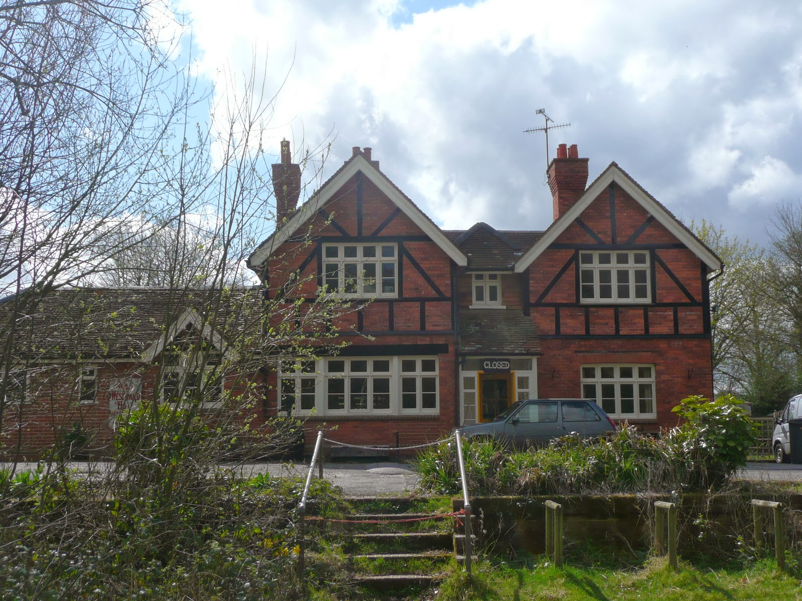
After this bridge, the path continues to one side of where the original railway line once ran as evidenced by another infilled railway bridge a little further on. The rest of the route to Christ’s Hospital is pleasant but fairly uninteresting although there is a pub, the Bax Castle right by the trackbed that might be worth a look.
I soon reached Itchingfield Junction, where this part of the line once diverged from the still operation Arun Valley Line between Horsham and Arundel. Here I had to leave the trackbed and the route north was via a track alongside the famous Christ’s Hospital School and then via a couple of country roads to regain the trackbed of the Guildford line about a mile later. The trackbed itself was gained via a curious spiral around an old overbridge that was still being used, despite there being no track to cross. It felt good to be back away from traffic, which had been rather a rude awakening for me. However, I was slightly alarmed by a sign suggesting that I should watch out for low flying aircraft! I wasn’t sure what this meant initially but a few metres further on I passed what was clearly an airstrip although there didn’t seem as though there was much activity today.
The first village on the route was Slinfold, although any hopes of seeing any remnants of the former station were soon dashed when I realised that it had been completely razed in favour of a caravan site. Pictures of what it once looked like can be found here http://www.subbrit.org.uk/sb-sites/stations/s/slinfold/index.shtml . The only clue that it was here at all are in the shape of a couple of cottages opposite the caravan site that are clearly in the style of the old London Brighton and South Coast Railway.
From Slinfold the line entered a narrow cutting and I found the going rather easy, probably on account of being downhill. As I was to discover the gradients on the line were surprisingly noticeable, probably a result of the line being built on the cheap. This is not altogether surprising for when the line was built this part of Sussex was probably fairly sparsely populated and expected traffic fairly light. At the end of the cutting I reached the so-called double deck bridge. This unusual structure was built because when the line was completed, the railway inspector was unhappy with the gradient from here to Rudgwick and the engineers were forced to re-profile the line, necessitating the addition of the upper deck, even though the lower deck had never been used. A stylised version of the bridge now serves as the logo for the entire route.
Rudgwick station had suffered a similar fate to Slinfold, although the site was now occupied by a medical centre and there was a small stub of the platform remaining, giving the hint of where it once was situated. Pictures of the original station can be found at http://www.subbrit.org.uk/sb-sites/stations/r/rudgwick/index.shtml
A little way past Rudgwick and I ran into the next major obstacle on the route. The only tunnel on the line is now closed, necessitating a diversion up and over the hill that the track once ran through. The southern portal of the tunnel is still extant, although bricked up to ensure that there are no ‘explorers’. It turns out that the tunnel is now home to a bat colony and as such is a protected habitat. Although the climb over the hill was rather unwelcome the woods at the top were rather special, being completely covered in wood anemones. The white carpet of flowers was definitely worth seeing and I soon forgot my cursing.
When I regained the trackbed, I was rather surprised to see that the northern portal of the tunnel had been completely buried, leaving only a vent presumably to let out the smell of bat guano (I didn’t venture too close to find out). A little further north I reached Baynards station. I find it ironic though that this station, which was principally built to please the local landowner, is the only one still remaining on this line and to see what it once looked like see here http://www.subbrit.org.uk/sb-sites/stations/b/baynards/index1.shtml
From Baynards it was a fairly easy ride to Cranleigh, again probably because of the gradient. As I got closer to Cranleigh, the number of people using the route increased significantly and I soon found that it was a popular route for dogwalkers much to my chagrin. When walking dogs don’t bother me much but bicycles and dogs clearly don’t mix! By the time I reached Cranleigh I gave up any pretence of wanting to continue to the end of the line at Bramley and Wonersh, another four miles or so further down the track. I began to realise how far from the car I now was and the fact that I had to do the ride all over again in the reverse direction! I shall complete the last bit another time.
The way back wasn’t too bad, although there were a couple of sections where I paid the price for some easy riding on the outward trip. The gradient up into Slinfold was a particular struggle and the bumpiness of the track was beginning to tell on my wrists. The trip did whet my appetite for exploring more of these lines. While they are unremarkable for walking, cycling gives these routes a different dimension and offers the great advantages of being able to cover a greater distance and in a much shorter time than walking. Being traffic free routes they are also less stressful than the type of cycling I gave up years ago, when it was my main means of transportation.
 |
| Heading Out of Southwater |
 |
| Site of Former Southwater Station |
For a complete route guide take a look at the excellent leflet produced by West Sussex County Council, which can be purchased as a hard copy for £2 or downloaded for free at http://www.westsussex.gov.uk/leisureandtourism/prow/pdfs/DownsLinkRouteGuide.pdf . If you don’t have your own bike or don’t want to be bothered transporting it, you can also rent bikes in Southwater at http://www.southwatercycles.com/
 |
| Platform Remnants |
 |
| Approaching Itchingfold Junction |
 |
| Countryside Near Christ's Hospital |
 |
| Regaining the Track |
 |
| Slinfold |
 |
| Double Deck Bridge |
From Slinfold the line entered a narrow cutting and I found the going rather easy, probably on account of being downhill. As I was to discover the gradients on the line were surprisingly noticeable, probably a result of the line being built on the cheap. This is not altogether surprising for when the line was built this part of Sussex was probably fairly sparsely populated and expected traffic fairly light. At the end of the cutting I reached the so-called double deck bridge. This unusual structure was built because when the line was completed, the railway inspector was unhappy with the gradient from here to Rudgwick and the engineers were forced to re-profile the line, necessitating the addition of the upper deck, even though the lower deck had never been used. A stylised version of the bridge now serves as the logo for the entire route.
 |
| Site of Rudgwick Station |
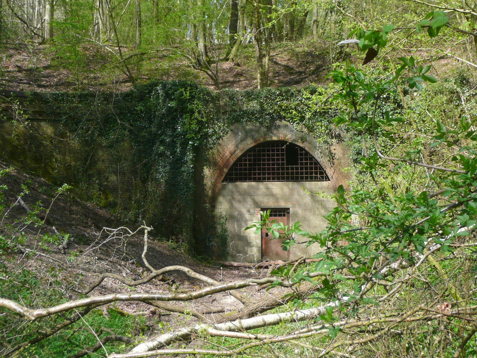 |
| Baynards Tunnel |
 |
| Baynards Station |
 |
| Baynards Pub |
 |
| Baynards Woods |
The way back wasn’t too bad, although there were a couple of sections where I paid the price for some easy riding on the outward trip. The gradient up into Slinfold was a particular struggle and the bumpiness of the track was beginning to tell on my wrists. The trip did whet my appetite for exploring more of these lines. While they are unremarkable for walking, cycling gives these routes a different dimension and offers the great advantages of being able to cover a greater distance and in a much shorter time than walking. Being traffic free routes they are also less stressful than the type of cycling I gave up years ago, when it was my main means of transportation.
Best done on a bike as you state. Although the section north of Bramley is muddy footpath and uphill from Chilworth!
ReplyDeleteI know you're right of course, but somehow the section that is not on the railway line carries little interest for me. In the case of old railway walks it's about the industrial archaeology for me, and not the scenery or the completeness of the route that it may be a fragment of...
ReplyDelete